As the Earth’s population grows, people continually feel the pressures of living room acting upon them.
While here in the
United States, we may still take fore granted the spacious lifestyles we lead, this is not the case in many places.
So what happens when the land runs out?
In some locations, the solution is to make more land.
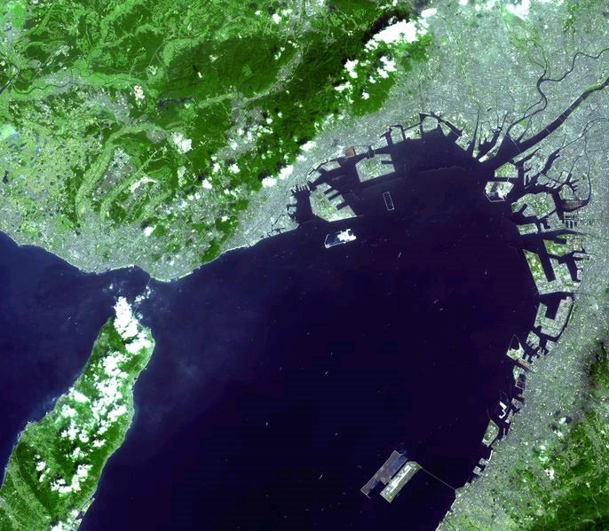
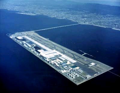
This is not a new concept as civilizations have fought the ocean for living space for centuries, however, some very new and amazing strategies have been taken to steal land from the oceans, perhaps one of the most amazing to date is the construction of the Kansai International Airport.
Economic pressures in
Osaka,
Japan and the lack of open space for a new airport have led to a 15 billion dollar man-made island in the
Osaka Bay.
The project has taken over 25 years to complete; the filling of the island itself required more than 10 million man hours; after which it was found that the island was sinking at a faster rate than calculated.
Shortly after the terminal construction began, engineers realized that the entire mass was sinking far more quickly than predicted and a massive system of jacks was devised to lift the entire structure as needed.
Today, the sinking rate of the island has dramatically decreased and the man made island has successfully with stood the impact of a nearby earthquake (Kobe earthquake, 1995) and several typhoons without any major damages. However, due to the extra costs, the airport is often times considered a white elephant; interest alone runs 560 million dollars a year leading to extremely high landing fees for incoming air traffic. Despite the struggles, over the last few years, the airport has been able to survive and construction on a second runway has begun with prospects of a third runway in the near future. The Kansai International airport now has over 40 international carriers and acts as the airport for most international travel in the Osaka area.
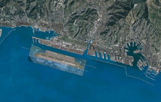
In Genova, Italy, Renzo Piano (also the designer of the airport terminal at Kansai) has suggested a major renovation of the port area; the plan includes relocating the city’s airport onto an artificial island similar to what was done for the Kansai International Airport. Here the projected budget for the airport is 2 billion euros or roughly 2.5 billion dollars, a price which seems somewhat more reasonable that the 15 billion dollars spent on the Kansai Airport. The image below shows a size comparison of Kansai International Airport layed over Piano's port renovation plan.
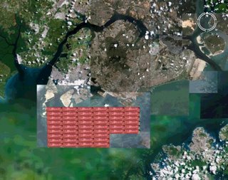
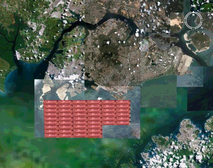
Other similar land forming projects are appearing all around the world such as the island “neighborhoods” near Dubai. The idea of creating islands becomes very powerful and very realistic. The question is, could the ability of building land begin to solve issues of space and population growth for certain areas of the planet. Singapore for instance is a tiny nation island of 690 square kilometers with a population of 4,400,000 and thus has one of the highest population densities in the world. As overcrowded as the island already is, the population has been increasing an average of roughly 2 percent over the last few years and in twenty years from now will be close to 6,500,000. Where can the country fit 50 percent more citizens without losing the little precious undeveloped land the country has held onto? Could more land be built in a similar fashion to that of the Kansai Airport construction? Adding about 40 percent of Singapore’s current land area in a mega-island construction could house the growing population in twenty years with about the same population density that exists now. But this much land, 260 square kilometers would be the equivalent of about 48 Kansai International Airports, and given the cost of one Kansai (15 billion dollars) the grand total would be near 720 billion dollars, about 600 billion less than the GDP for Singapore. The option may not be possible quite yet, but the budget for the Genova airport already seems much more feasible at a projected 2.5 billion dollars (thought the Genova airport will be approximately half the size of the Kansai airport). It still seems doubtful that the price of building land will justify a solution to the lack of space due to the planet’s population growth, although as seen with the Kansai airport, it can offer a solution to situations.