The final phase of this mapping project goes beyond mapping only major air routes.
This map super-imposes the world's four main modes of transportation used to physically connect every corner of the globe.
The mapping explores the world’s largest air, shipping, rail and roadway networks.
The map is done as such that each layer of information is displayed on the map as a partial transparency, thus the areas of the map which show the whitest moments represent the areas of the globe in which there are the highest concentration of intersections between the world’s largest transportation networks.
These are the areas of the globe are the areas which move most of the world’s people and goods around the world.
These are very important areas for the global economy and have a large impact on most of the world; they represent some of the wealthiest areas of the world and are also among the most populated places on the globe.
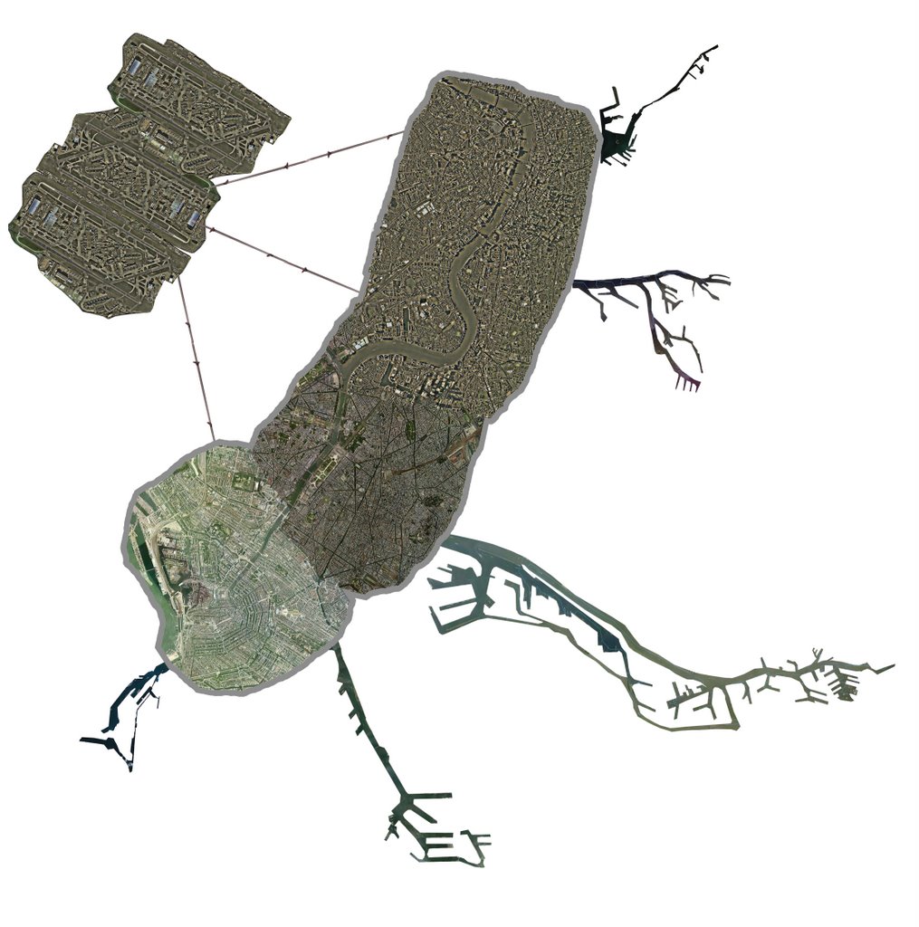
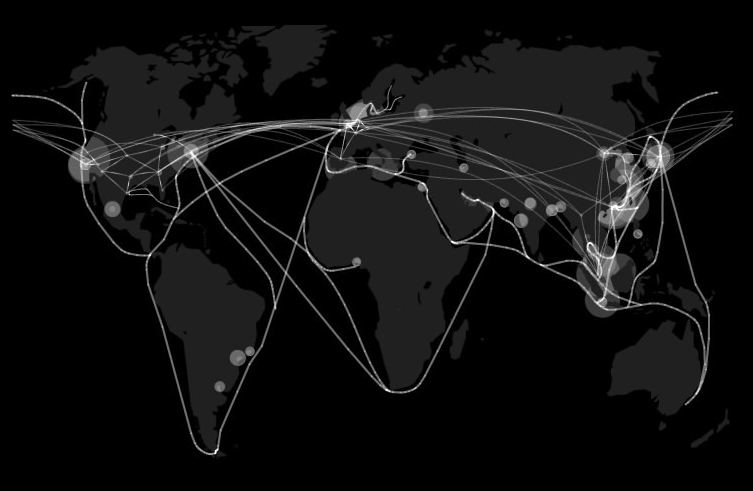
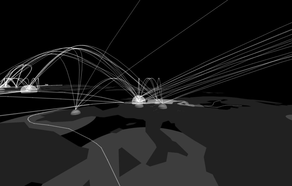
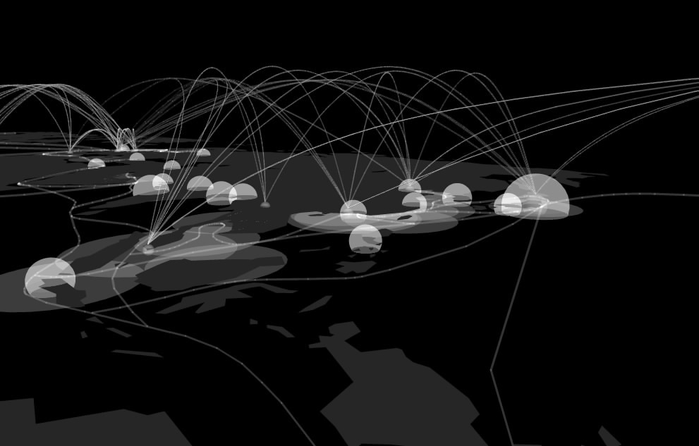
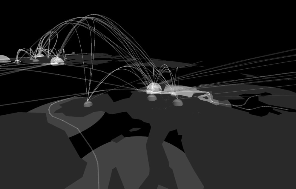
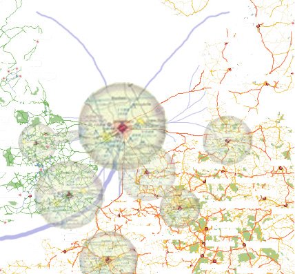
Below is a plan view of a map of the earth. The world’s mega cities (that is cities containing more than 10 million people) are plotted along with the world’s largest ports, airports, rail networks, interstate infrastructures and the most commonly traveled air routes and shipping lanes. The shipping lanes and air routes are mapped as lines of connections, the mega cities and airports are mapped as domes with radii in correspondence to global size, and the ports, interstate infrastructures and rail lines are mapped as flat circles centered on the mega cities they are tied to, the radii of these forms also have been derived from the global scale of these networks.

image 1

image 2
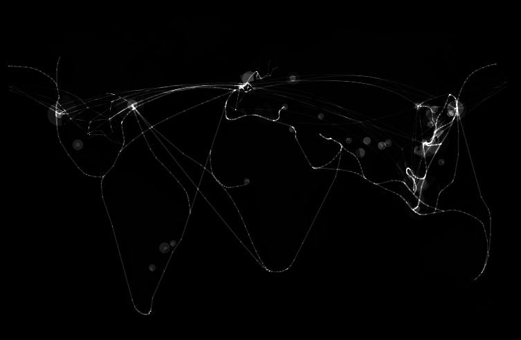
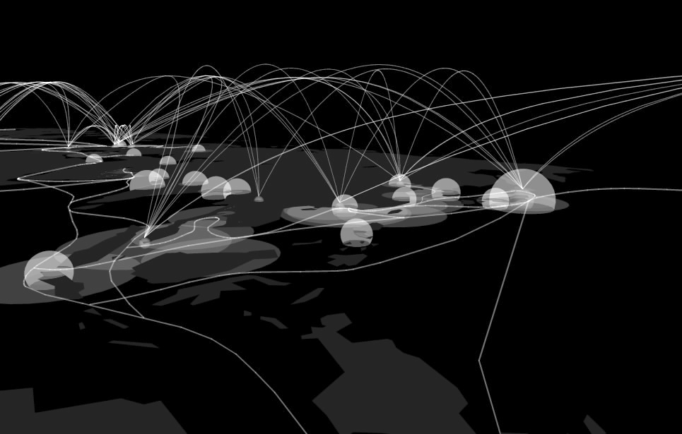
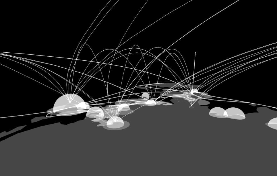
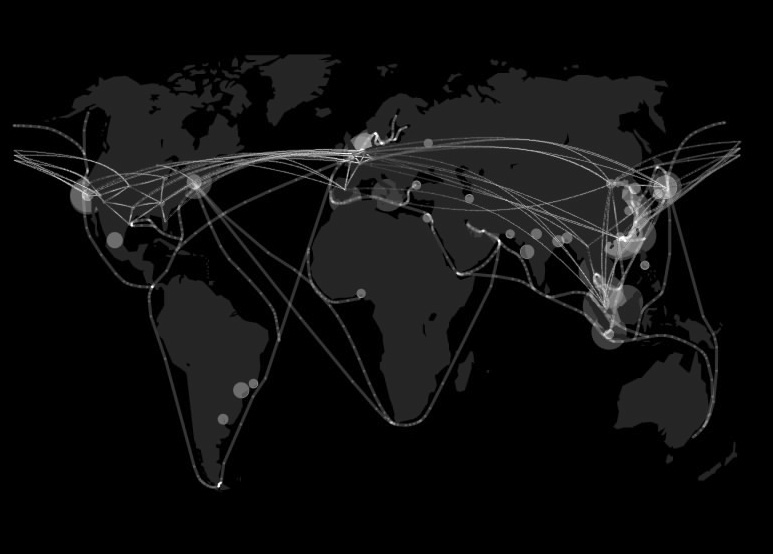
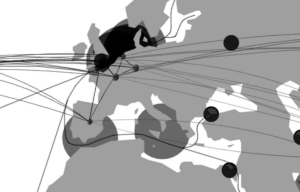
Shown above is the identical map of the globe seen before but the levels of the image have been altered to create a clearer understanding of the most critical areas of the overlapping of transportation networks. Four focus areas immediately become obvious, the eastern coast line of Asia between China and Japan especially, Northern Europe, the US northeast (centered on New York) and the US west coast (centered on Los Angeles). Following are several perspectives of the map including a front elevation view showing an interesting pattern across the globe, a perspective view of the Asian east coast from the Pacific Ocean and a second image taken over Russia and a perspective of Northern Europe taken form the northern part of the African continent, in that order.
image 3

image 4

image 5

image 6
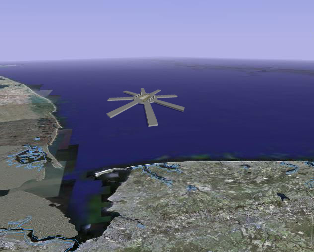
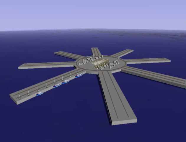
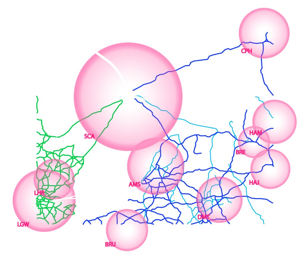
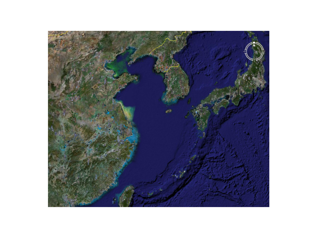
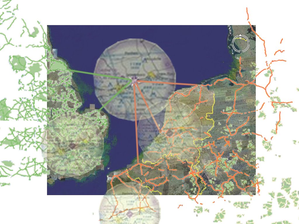
The next map below describes the areas most affected by the largest transportation networks and which areas of the globe are less accessible than others. Following are two more maps, the first of which shows the population of the areas most affected by my mapping of transportation and the second which highlights GNP per capita (darker countries have higher GNP) in the areas of my mapping versus other areas of the globe. And finally, the last two images describe one of the most interesting sites on the globe, the North Sea. The Google Earth map (image 10) locates the road map that follows it. The last map is a transportation map, it disregards all information except that discribing transportation networks. The last map collage explores what the North Sea in northern Europe might look like if a "Segue City" island transportation hub (discussed below) were built to serve the European continent. In this map, the red, yellow and green lines represent major highways and interstates in northern Europe and England, the circles represent air space superiority for the largest airports in the area and the gray lines are shipping routes too and from the city. These maps are, however, only speculation of what could be if a mega "Segue City" was built in the North Sea.

image 7

image 8

image 9
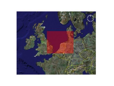
image 10

image 11
Our lives today are based on a global economy and as the population of the world continues to grow, a global economy will be increasingly important for our living standards and perhaps for developing the situation of other areas that seem left out of the global economy at this time. I believe the that it will be increasingly important for the areas highlighted by this mapping to work as efficient and effective segues of goods and people and as the main distribution hubs of the world. In many of these areas, problems of space and ugly industrialization are major concerns as they will continue to be. An interesting study titled “What if Denmark was the Port to the New Europe?” describes these issues in Denmark and suggests a solution involving the construction of a new “super port” as a man-made island replacing the other ports which now crowd the Danish coastline. The study predicts great profit for the Danes and a higher quality of life due to the prime real estate which would be yielded if all of the ports were moved offshore. Similar situations are faced in all of the areas highlighted by the mapping and so the thought arises, what would happen if mega offshore “Segue Cities” were created to move the unsightly and ever growing transportation network hubs to a central location offshore? Just as airline hubs were formed to make airline travel more efficient, can this concept not be applied to all forms of transportation of both people and goods on a global scale to make international trade more efficient as a whole? For the next part of the project, I plan to explore the creation of “Segue Cities” which could operate in the strategic locations pointed out to create a new and more efficient means of global travel and transportation.