Below is a plan view of a map of the earth. The world’s mega cities (that is cities containing more than 10 million people) are plotted along with the world’s largest ports, airports, rail networks, interstate infrastructures and the most commonly traveled air routes and shipping lanes. The shipping lanes and air routes are mapped as lines of connections, the mega cities and airports are mapped as domes with radii in correspondence to global size, and the ports, interstate infrastructures and rail lines are mapped as flat circles centered on the mega cities they are tied to, the radii of these forms also have been derived from the global scale of these networks.
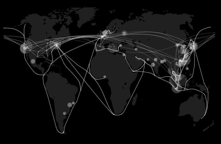
image 1
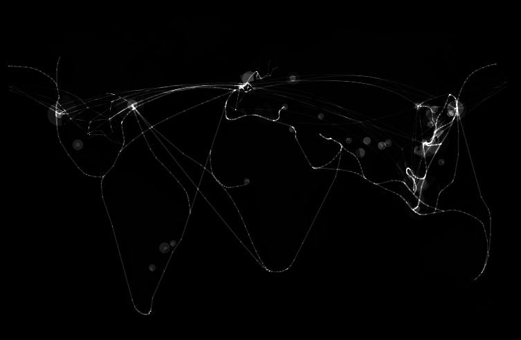
image 2
Shown above is the identical map of the globe seen before but the levels of the image have been altered to create a clearer understanding of the most critical areas of the overlapping of transportation networks. Four focus areas immediately become obvious, the eastern coast line of Asia between

image 3
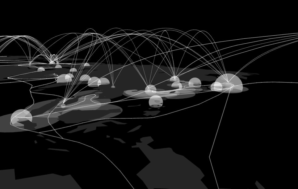
image 4
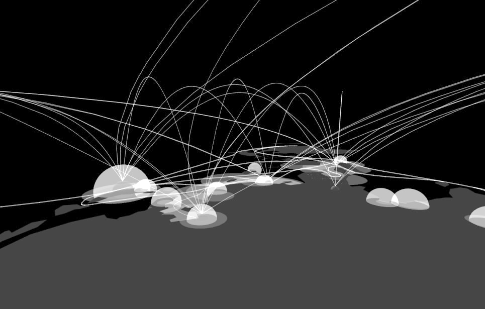
image 5
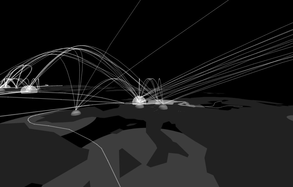
image 6
The next map below describes the areas most affected by the largest transportation networks and which areas of the globe are less accessible than others. Following are two more maps, the first of which shows the population of the areas most affected by my mapping of transportation and the second which highlights GNP per capita (darker countries have higher GNP) in the areas of my mapping versus other areas of the globe. And finally, the last two images describe one of the most interesting sites on the globe, the North Sea. The Google Earth map (image 10) locates the road map that follows it. The last map is a transportation map, it disregards all information except that discribing transportation networks. The last map collage explores what the North Sea in northern Europe might look like if a "Segue City" island transportation hub (discussed below) were built to serve the European continent. In this map, the red, yellow and green lines represent major highways and interstates in northern Europe and England, the circles represent air space superiority for the largest airports in the area and the gray lines are shipping routes too and from the city. These maps are, however, only speculation of what could be if a mega "Segue City" was built in the North Sea.

image 7
![]()
image 8
![]()
image 9

image 10
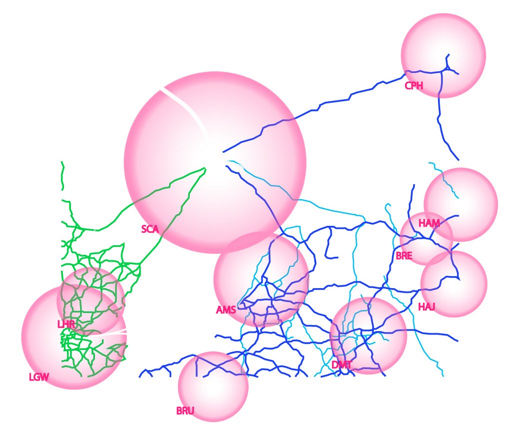
image 11
Our lives today are based on a global economy and as the population of the world continues to grow, a global economy will be increasingly important for our living standards and perhaps for developing the situation of other areas that seem left out of the global economy at this time. I believe the that it will be increasingly important for the areas highlighted by this mapping to work as efficient and effective segues of goods and people and as the main distribution hubs of the world. In many of these areas, problems of space and ugly industrialization are major concerns as they will continue to be. An interesting study titled “What if
2 comments:
steven,
it would be helpful to locate image "euro road map". it is difficult to know exactly where that is in the world - perhaps another image or a link to previous posts in your process.
This kind of information is very limited on internet. Nice to find the post related to my searching criteria. Your updated and informative post will be appreciated by blog loving people.
Post a Comment